

Watches & Warnings (Iowa)
Last Updated: Loading...
Active Products
Loading...
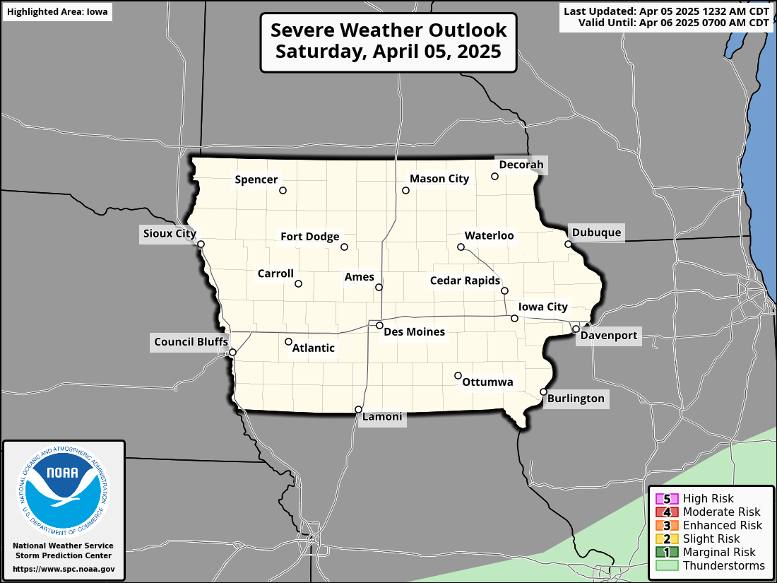
Severe Weather Outlook
Day 1 Severe Weather Outlook
KDMX Radar Loop
Radar imagery from the National Weather Service Des Moines WFO


Grey Skies: Clouds, Drizzle, Weekend Rain Ahead
If you’ve been longing for sunshine, you’ll have to wait a little longer. The forecast for Iowa over the next few days paints a picture of overcast skies, misty conditions, and light drizzle, with a significant rain system approaching by the end of the week.
Current Conditions: A Blanket of Clouds
A vast stratus field stretches across the region, leaving Iowa under thick, gray skies. The overcast layer extends as far as the northern Ozarks and central Nebraska, with no clearing anticipated until at least Saturday. A small break in the cloud cover is visible over parts of southern and eastern Wisconsin, but for Iowans, it’s cloudy weather all the way.
Drizzle and Mist on the Horizon
As southwest winds slowly pull more moisture into the region tonight through Thursday night, expect intermittent light drizzle and mist to develop.
Temperatures: Generally at or above freezing, reducing concerns about icy conditions.
Exceptions: A low probability (<20%) exists for temperatures to remain below freezing in northeast Iowa late tonight or early Thursday morning, which could cause brief slick spots if drizzle develops.
Fortunately, precipitation amounts will be minimal—less than a hundredth of an inch—and significant impacts are not anticipated.
Friday: Rain Returns
By Thursday night, a low-pressure system will move into eastern Oklahoma, later tracking over Missouri and interacting with a second, deeper trough. For Iowa, this means:
Rain Chances: The first wave of rain will arrive Thursday night, with a second, more prolonged round lasting through Friday and into Friday night.
Temperatures: Above freezing, so all precipitation should fall as rain.
Rainfall Totals: Light, around 0.25–0.33 inches overall.
While impacts will be minimal, the period will feel damp and gloomy, so plan accordingly for a wet end to the workweek.
Weekend Respite?
The weekend could bring a brief break as the late-week trough exits to the east. With high-pressure influence and zonal steering flow, clearing skies are possible, but low-level flow remains uncertain. Don’t pack away your rain gear just yet.
Looking Ahead: Next Week’s System
Early next week, a stronger 500 mb shortwave is expected to move out of the Rockies, deepening over the Midwest by Monday. However, the track of this system remains uncertain:
GFS Model: Brings the system directly over Iowa, increasing precipitation chances.
EC Model: Tracks it further south over Missouri and Arkansas, leaving Iowa mostly dry.
GEM Model: Offers a compromise, suggesting partial precipitation over southern Iowa.
For now, expect 20–40% precipitation chances over southern Iowa Monday into Monday night, with more details as model consensus improves.
What to Keep in Mind
Drizzle and Mist: Minimal but persistent tonight through Thursday night.
Rain: Expect a soggy Friday, though impacts will be low.
Weekend: A potential for clearing skies, though uncertainty remains.
Early Next Week: Stay tuned for updates as the next system approaches.

Gray Days for Christmas with Rain Chances Later This Week
Expect mild, cloudy weather for Christmas Eve and Christmas Day, with rain chances increasing late in the week and into the weekend.
Short-Term Forecast (Tonight through Christmas Day)
Confidence: HighThis afternoon and through tonight, Iowa is experiencing a shift in weather patterns as broad upper ridging develops over the central U.S., ahead of a developing trough on the west coast. High pressure from the Dakotas and Minnesota will build southward into Iowa tonight, leading to a cool but dry evening. Clouds have been variable across the state today, with mostly clear skies in central Iowa, while northern Iowa is seeing a push of stratus clouds. This stratus is key to overnight conditions, as it will determine whether fog develops in the region.
With cloud cover expected to persist, temperatures tonight will not drop much, staying in the 20s. However, areas that remain clear could see patchy fog develop, though models vary on the timing and locations of dense fog. As a result, a low-confidence forecast is in place, but patchy fog is possible across the state overnight. Christmas Eve and Christmas Day will continue with cloudy skies, as the surface high slowly shifts east. Temperatures will be in the 30s across the state, with dry conditions for travel. While there might be a few breaks in the clouds, especially in the western parts of the state, the overall pattern will keep conditions gray for much of the holiday.
Extended Forecast (Thursday through Sunday)
Confidence: MediumA more active weather pattern is expected to set in later this week as a broad upper trough moves out of the west. As this system advances, it will pull moisture from the Gulf of Mexico, bringing a series of rain showers to Iowa. The first round of rain will arrive Thursday night into Friday, with another round likely on Saturday.
Rainfall is expected to be moderate, with most areas seeing between 0.10" and 0.25" of rain, though the chance for more significant rainfall (0.50" or more) remains low. Despite the rain, temperatures will remain well above normal for late December. Highs will range from the mid-40s to lower 50s, with Friday and Saturday potentially seeing the warmest temperatures of the week.
The combination of increased moisture and warm temperatures for late December is quite remarkable, as 850mb temperatures will stay above 0°C across much of the country. The warmer air, coupled with moisture from the Gulf, will create the potential for several rainy days through the weekend.
Looking Ahead
While Christmas Eve and Christmas Day will remain mostly cloudy and dry, expect rain chances to return later this week. Temperatures will stay mild, with highs in the 40s and 50s, well above normal for late December. Be prepared for several rainy days from Thursday through the weekend, with moderate rainfall and potential for localized flooding. For those traveling, the dry conditions on Christmas will be a welcome relief before the rain sets in.
Mild, Cloudy Days Ahead with Rain Chances Late This Week
Iowa will experience a period of mild temperatures and gray skies through Christmas, with rain chances increasing late in the week.
Short-Term Forecast (Tonight through Christmas Day)
Confidence: HighIowa is entering a period of mild temperatures and cloudy weather. A surface trough currently stretching across parts of Iowa and Minnesota will push through today, bringing cooler air behind it. While temperatures are still in the mid-30s to upper 30s across the state, a weak cold front will move through and slightly lower temperatures for tomorrow, but no major precipitation or strong winds are expected.
Tonight, as a high-pressure system builds into the region, we’ll see stratus clouds moving in from the north. These clouds will likely linger for several days, making for a mostly gray Christmas period. There is also a chance of fog developing in some areas, particularly where the clouds haven’t yet reached. The fog may be dense in spots, especially in western and southern Iowa, but it is unlikely to cause major issues. Temperatures tonight will vary across the state: areas where the clouds remain will have slower temperature drops, while clear areas may experience radiational cooling, leading to cooler temperatures.
On Christmas Eve and Christmas Day, the cloud cover will persist, keeping temperatures stable with highs mainly in the 30s to low 40s. There will be little to no diurnal temperature variation, and while no precipitation is expected, the cloudy skies will make for a dreary holiday.
Long-Term Forecast (Thursday through Sunday)
Confidence: MediumLater this week, the weather pattern will become more active, with rain chances returning. A series of weather systems will move through the Midwest, bringing multiple chances for rain between Thursday night and Saturday. The first system will emerge from the southern High Plains on Thursday and track across the Midwest, with the potential to bring rain to Iowa Thursday night or Friday. There is some uncertainty in the models, with differences in the track and strength of this system. The GFS model shows a stronger, more northern system, while the European model places the system further south.
Despite these uncertainties, it is highly likely that rain will move through Iowa between Thursday night and Saturday. The most likely period for rain is Friday, with precipitation expected to be mostly in the form of rain, given the above-normal temperatures and dewpoints above freezing. While the rain could lead to wet roads, no winter weather or hazardous conditions are expected at this time. The rain will likely be light to moderate, but travelers should be prepared for possible wet conditions.
Looking Ahead
Iowa will see generally mild temperatures and cloudy conditions through Christmas, with no significant precipitation expected. However, by the end of the week, rain chances will increase, and the weather pattern will become more active, particularly Thursday through Saturday. While temperatures will remain above normal, the rain could cause some minor travel disruptions, but there are no major winter weather concerns at this time. Stay tuned for further updates as we monitor the developing system later in the week.

Mild Days Ahead with Rain Chances Later This Week
Iowa can expect a relatively quiet and mild week ahead, with some cloud cover, light precipitation, and cooler temperatures later in the week.
Short-Term Forecast (Tonight through Monday Night)
Confidence: HighThe next few days will be generally quiet, with milder temperatures moving in as a warm front lifts across the state. Currently, a weak low pressure system over the Dakotas is bringing much milder air into the region. By this evening, the warm front will be northeast of Iowa, and while moisture remains scarce over much of the nation, a narrow ribbon of weak moisture moving northward could bring some light precipitation to the northern parts of the state overnight. However, the moisture is expected to be minimal, and any precipitation that does reach the ground will be very light—just a few flurries with no significant accumulation.
Lows tonight will be mild, ranging from the mid-20s in the northwest to the mid-30s in the southeast. Winds will shift to the northwest tomorrow, bringing slightly cooler air into the region, and cloud cover will likely persist through the day. Highs on Monday will be similar to Sunday, ranging from the low 30s in the north to the mid-40s in the southeast. As Monday evening approaches, skies will remain partly to mostly cloudy, and overnight lows will drop into the upper teens to mid-20s.
Long-Term Forecast (Tuesday through Sunday)
Confidence: Low to MediumThe weather pattern for the remainder of the week will be mild but mostly cloudy. A weak high-pressure system will move over the region early Tuesday, but a trough aloft will keep cloud cover in place. There’s a chance of rain for southeastern Iowa Tuesday afternoon and night as a system passes southeast of the state, but much of Iowa will remain dry with just extensive cloud cover.
Christmas Day itself will be quiet, with continued cloudiness. The next system to watch will arrive Thursday night into Friday, bringing better chances for moisture and a more significant precipitation event. While the system is expected to bring rain, the track of the storm is still somewhat uncertain, and the GFS and EC models differ on its exact path. Regardless, the Thursday-to-Sunday period looks wet, with persistent rain and the possibility of fog or lower visibility, especially in areas where snow cover from earlier in the week begins to melt. This could impact travel, so it’s important to stay updated on the latest weather conditions, particularly for travel across northern and eastern Iowa.
Temperatures for the remainder of the week will stay mild, with highs in the 40s and lows in the 20s and 30s, well above the seasonal average.
Aviation Forecast (00Z TAFs through 00Z Tuesday)
Mostly VFR conditions for much of the forecast period, though northern Iowa may experience some MVFR ceilings on Monday. Winds will shift overnight, from the south to the west and then northwest as a low pressure system moves through northern Iowa. Precipitation will remain mostly to the north and northeast, with the best chance for any precipitation staying out of the main forecast area.
Looking Ahead
While the start of the week will be mild and quiet, prepare for wetter conditions toward the end of the week, particularly Thursday through Sunday, with rain and possibly fog or lower visibility. Temperatures will remain above normal, with highs in the 40s and lows in the 20s and 30s. Stay informed as we track the development of rain and fog, especially for those planning to travel during the holiday week.