

Watches & Warnings (Iowa)
Last Updated: Loading...
Active Products
Loading...
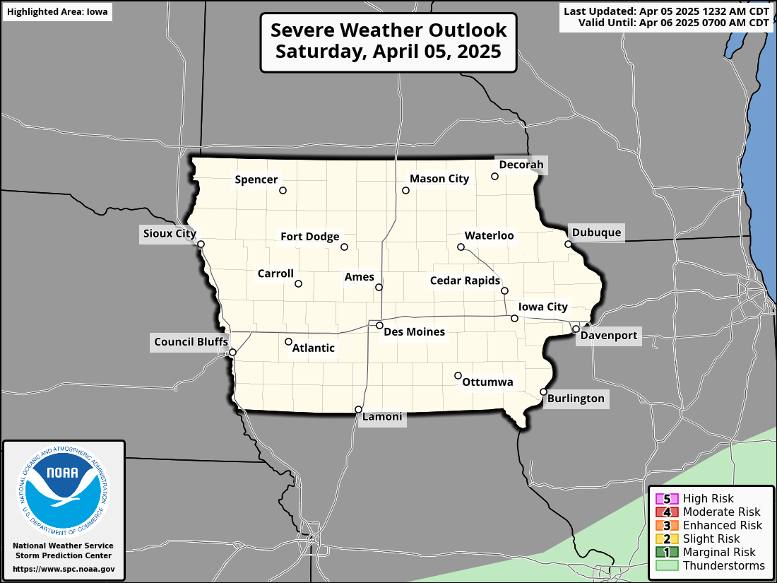
Severe Weather Outlook
Day 1 Severe Weather Outlook
KDMX Radar Loop
Radar imagery from the National Weather Service Des Moines WFO


A Chilly Transition: Iowa Weather Updates and Weekend Outlook
As we move through the week, Iowa residents can expect a gradual transition into colder weather accompanied by varying cloud cover and a few chances for light snow. Here’s what’s in store:
Today’s Weather (Tuesday)
The day begins relatively calm, but a shift is underway. A cold front aloft, supported by an Arctic high-pressure system over southern Canada, will bring colder air and increased cloudiness by tonight.
This morning, central Iowa will experience a wind shift as the upper-level cold air pushes southward. The US30 corridor, already colder due to lingering snow from last week, will remain a few degrees chillier than surrounding areas. Highs across central Iowa will range from the upper teens to lower 20s under partly sunny skies, though areas west of Iowa will likely remain mostly cloudy.
By tonight, a weak ridge will build over the region, resulting in clear skies and light north winds. Overnight temperatures will drop to the single digits, with some areas approaching zero by Wednesday morning.
Midweek Weather (Wednesday and Thursday)
The ridge shifts eastward on Wednesday, bringing a more westerly component to winds aloft. While warmer air will build above the surface, a strong inversion will prevent much of this warmth from reaching the ground. Highs on Wednesday will remain consistent with Tuesday, staying in the upper teens to lower 20s despite more sunshine.
By late Wednesday night, a northern stream wave will approach Iowa. While a separate southern system will track far to the south, the northern wave could bring light snow to Iowa Thursday evening. Current guidance suggests a dusting of accumulation is possible, and snow chances (PoPs) have been adjusted to 20–30% for Thursday night.
Thursday will see some slight warming ahead of the cold front, with highs recovering to the upper 20s to around 30 degrees. Overnight temperatures will once again fall back into the single digits.
Long-Term Forecast (Friday through Monday)
Confidence in the extended forecast is moderate, with key details still developing.
• Friday: A return to northwest flow will follow the passage of Thursday’s front, keeping temperatures steady. Highs will remain in the upper 20s.
• Saturday-Sunday: A quick-moving system from Canada will likely arrive over the weekend. Model guidance varies, with one scenario favoring a southerly track and slightly higher snow chances for Iowa, while another suggests a northern track with less impact. Regardless of the exact path, light snow accumulations are possible, particularly Saturday night into Sunday. Highs will remain in the upper 20s both days, though Sunday may trend slightly cooler.
• Monday: Colder air will settle in, with highs dropping to the mid-teens in northern Iowa and the lower 20s in the south. Further adjustments may be needed as models refine their predictions.
Key Takeaways
• A colder pattern is taking hold, with highs mostly in the upper teens to lower 20s through midweek.
• Light snow is possible Thursday evening and again over the weekend, though accumulation will likely remain light.

ALERT: Snow Squall Warning Issued
A dangerous snow squall is impacting portions of central Iowa.
The National Weather Service (NWS) in Des Moines has issued a Snow Squall Warning for several counties in central Iowa, including Polk, Story, Greene, Madison, Guthrie, Boone, Adair, Dallas, and Warren. The warning remains in effect until 8:30 AM CST, with rapidly deteriorating travel conditions expected.
At 7:22 AM CST, radar and webcam observations detected an intense snow squall along a line extending from Ogden to De Soto to 4 miles east of Lenox, moving east at 25 mph. This squall is producing intense bursts of heavy snow, reducing visibility to less than half a mile. While winds are generally below 15 mph, blowing snow is exacerbating visibility issues, creating potentially life-threatening travel conditions.
The warning impacts major roadways, including Interstate 35 between mile markers 45-72 and 87-126, Interstate 80 between mile markers 90-142, and Interstate 235 between mile markers 1-14. Cities within the affected area include Des Moines, Ames, West Des Moines, Ankeny, Urbandale, Indianola, Boone, Winterset, and Jefferson, among others.
Travelers are advised to slow down and exercise extreme caution as conditions can change suddenly, leading to whiteouts and slick roads. If possible, avoid or delay travel until the squall passes. For those who must travel, additional time and vigilance are essential to navigate the hazardous conditions safely.

Snow and Below-Average Temperatures Expected Through the Weekend
Snow is expected to impact Iowa on Thursday, with colder temperatures settling in beyond, and another system to monitor for Sunday.

KEY MESSAGESThursday Snow (90-100% confidence): Snow is expected, especially across central and southern Iowa, with 1-3 inches possible and locally higher amounts. The northern extent of the snow remains uncertain.
Below Average Temperatures: Cold air will settle in through the weekend, with temperatures staying below average for at least the next week.
Weekend System (Sunday): A large system is expected to impact the region on Sunday, with the highest snowfall amounts likely south of Iowa, but this may change. Keep monitoring the forecast.

Short-Term Forecast (Today through Thursday)
Confidence: HighIowa is seeing colder air move in as northwest winds bring dry, cool conditions. Wind gusts of up to 30 mph will continue through the morning hours, especially in the northern and eastern parts of the state. Despite breaks in the clouds, temperatures will remain cold, with highs only in the 20s and 30s.
Tonight, cloud cover will increase as a clipper system moves in from the Pacific Northwest. The system is expected to bring snow, with amounts ranging from 1 to 3 inches across central Iowa. While there’s a high degree of confidence in the general snow forecast, localized snowfall amounts may be higher, particularly along the I-80 corridor. Several factors, including vertical motion, instability in the dendritic growth zone (DGZ), and potential for higher snow ratios, could lead to increased snowfall in certain areas. Some models are showing potential for snow amounts of 3-4 inches in localized areas.
Extended Forecast (Friday through Sunday)
Confidence: MediumAs snow from Thursday night clears out, the colder temperatures will become more pronounced, with highs for the weekend expected to drop into the teens. The biggest concern beyond Thursday is the large system expected on Sunday. Ensemble guidance shows that the highest snowfall amounts may be focused on areas south of Iowa, with parts of northern Missouri and eastern Iowa seeing the heaviest snow. Around 40% of model members suggest more than 4 inches of snow for far southern Iowa, but there is still significant uncertainty regarding the system's exact track and intensity.
Currently, snowfall amounts are forecast to be moderate, but the potential for higher snow totals remains as snow ratios could exceed 10:1. Confidence in exact snowfall amounts remains low (around 20%), and the forecast will need to be monitored as we get closer to the event.
Looking Ahead
A major shift in weather patterns is expected to take place next week, with an upper-level low settling over the Great Lakes region, bringing an extended period of below-average temperatures. Highs will remain in the teens, with lows approaching zero, making for a prolonged cold snap. Snow from the weekend system could add to the cold, but the focus will be on frigid temperatures that could last through the workweek.

Flurries, Gusty Winds, and Snow Chances Ahead
Iowa will experience flurries, gusty winds, and colder temperatures through the week, with snow expected on Thursday and colder, winter-like conditions following.
KEY MESSAGES:
Today: Light snow and rain south of Interstate 80, with temperatures hovering around freezing. Some slick spots on roads are possible due to slush, but accumulation on grassy surfaces will be minimal.
Thursday: Snow is expected, primarily in central and southern Iowa, with potential for advisory-level snowfall. Travel impacts are possible during the day.
Colder Weather: Winter conditions will take hold starting Thursday, with temperatures dropping into the teens by early next week. Snowfall amounts and winter weather impacts are still being monitored.
Short-Term Forecast (Today through Wednesday)
Confidence: MediumA 500mb low pressure system has continued to deepen overnight, bringing precipitation to Iowa, primarily focused along and south of Interstate 80. As the system moves east, rain and snow will continue to shift southeast, with temperatures hovering around freezing through the morning in the southeast. Although the melting layer is shallow, temperatures are warm enough to limit accumulation on grassy surfaces. However, roadways could still be slick due to slush, and localized higher amounts of snow are possible along a deformation axis forming over eastern Iowa.
Throughout the afternoon, gusty winds up to around 30 mph will accompany light flurries. Cold air advection (CAA) will steepen lapse rates in the planetary boundary layer (PBL), contributing to the flurries, but due to shallow saturation and subsidence, snowfall will remain light. The gusts will decrease quickly as cloudiness dwindles, and we can expect clearing skies in the western parts of the state. Temperatures will remain near freezing for much of the day, with lows expected to drop into the teens in the northern and western areas overnight due to radiational cooling.
Thursday and Beyond: Snow and Winter Conditions
Confidence: Medium to HighThe next significant weather system arrives Thursday, bringing snow primarily to central and southern Iowa. This time, temperatures will be cold enough to ensure snow as the primary precipitation type. Lift is expected to maximize in the mid-morning to midday hours, with around 50% of ensemble members predicting at least 1 inch of snow for the day. There are factors that could lead to higher snowfall amounts, especially due to the magnitude of forcing and its overlap with the dendritic growth zone (DGZ). Forecasts suggest the potential for advisory-level snowfall in a narrow band, and this will need to be closely monitored. Travel impacts are likely, especially during the daytime on Thursday.
After Thursday’s snow event, colder winter conditions will settle in. An energetic trough from the Pacific Northwest will dive southeastward, bringing colder temperatures to the region. Although deterministic models are trending southward with snowfall forecasts, it’s important to monitor the forecast closely as this system develops. Iowa may experience some winter weather impacts, though the exact details are still uncertain.
Looking Ahead
As we move into early next week, an upper-level closed low will descend upon the Great Lakes region, ushering in even colder air from an Arctic high in Canada. Highs are expected to drop into the teens early next week, with cold temperatures likely sticking around through at least the rest of the workweek. Snowfall from the weekend system will be more confined to the southern parts of the state, but overall winter conditions are set to take hold, with the potential for snow and other winter weather impacts to be monitored closely.
Stay informed as the weather continues to evolve, especially as we approach Thursday’s snow event and the colder temperatures expected next week. Be prepared for slick roads, gusty winds, and winter weather impacts as the season settles in.