

Watches & Warnings (Iowa)
Last Updated: Loading...
Active Products
Loading...
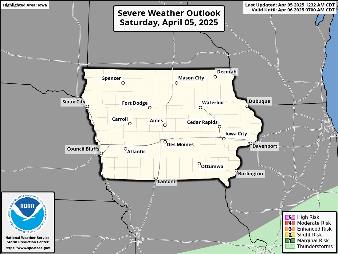
Severe Weather Outlook
Day 1 Severe Weather Outlook
KDMX Radar Loop
Radar imagery from the National Weather Service Des Moines WFO


Winter Storm Warning: Significant Snowfall Expected Across Much of Iowa
Iowa is preparing for widespread, significant snowfall starting late tonight, with hazardous travel conditions expected through Wednesday.

Acute CriticalAlert
Heavy Snowfall Expected: Significant snow will impact much of Iowa, with the highest accumulations (5-8 inches) expected in southern and central Iowa.
Winter Storm Warning: A Winter Storm Warning is in effect from midnight tonight until midnight Wednesday night for southern and central Iowa.
Hazardous Travel: Snow-covered and slick roads will create hazardous travel conditions, especially during the Wednesday morning and evening commutes.
Snow Rates: Snow will fall at rates of a quarter to half an inch per hour, with some periods seeing rates of up to three-quarters of an inch per hour.
FORECAST OVERVIEWSnow will begin over far western Iowa around midnight tonight, spreading into central and eastern Iowa after midnight. The heaviest snow will accumulate in southern and central Iowa, where 5 to 8 inches are expected. Snowfall rates will vary but will generally be between a quarter to half an inch per hour, with some localized periods of heavier snow. Visibility will be reduced in the falling snow, but blowing snow is not expected to be a significant issue, as winds will remain relatively light, averaging 10 to 15 mph.
The snow will taper off from west to east late Wednesday afternoon into Wednesday evening, but hazardous travel conditions will persist through the day, particularly during the morning and evening commutes.
WINTER STORM WARNING DETAILSWhat: Heavy snow expected, with total accumulations between 5 and 8 inches in the warning area.
When: Midnight tonight to midnight Wednesday night.
Impacts: Travel will be very difficult, particularly during the Wednesday morning and evening commutes. Roads will be snow-covered and slick, creating hazardous driving conditions.
PRECAUTIONARY ACTIONSTravel Safety: If you must travel, keep an extra flashlight, food, and water in your vehicle in case of emergency.
Stay Informed: For the latest travel conditions and road updates, check the Iowa 511 app, visit www.511ia.org, or dial 511.
Prepare for a challenging commute as snow impacts much of Iowa. Make sure to stay informed and take necessary precautions to ensure your safety during this winter weather event.

Light Snow Today, Cold Front Arriving, and a Warm-Up Next Week
Iowa will experience light snow today, followed by a cold front tonight, but a warmer period is expected next week.
KEY MESSAGESLight Snow Today: Light snow continues across central Iowa, with minor accumulations expected, generally half an inch or less. Snow should move out of the area over the next few hours.
Cold Front Tonight: A cold front will push through the state this evening, bringing a brief chance for flurries or light snow showers, followed by colder air overnight.
Weekend Weather: Temperatures will fluctuate this weekend as a broad upper trough remains over the eastern U.S., but precipitation chances are limited.
Warm-Up Next Week: A warm-up is expected by Tuesday and Wednesday next week, with above-normal temperatures as the polar jet lifts north.
Short-Term Forecast (Today through Tonight)
Confidence: HighBroad northwest flow aloft continues across the central U.S., maintaining a large longwave trough over eastern North America. This has led to the development of light snow across central Iowa, with visibility dropping to below 2 miles in some areas and minor accumulations of less than half an inch. The snow will move east and out of the state as the warm advection and associated isentropic lift weaken. However, some light snow or flurries may persist through the day, particularly in areas affected by lingering mid-level forcing. While snowfall will remain light, there could be some minor impacts, but no significant accumulation is expected.
Temperatures will continue to rise today ahead of a cold front. The air mass over Nebraska and South Dakota is already in the upper 20s to near 30°F, and this will push temperatures into the low 30s across much of southern and western Iowa. The front is expected to arrive this evening, bringing a brief window of flurries or light snow showers along with it. As the front passes, colder air will move in overnight, with temperatures dropping for Thursday.
Extended Forecast (Thursday through the Weekend)
Confidence: MediumThe broad upper trough across the eastern U.S. will gradually lift northeast through the weekend, bringing a roller-coaster of temperatures. Several shortwaves will pass through the backside of the trough, potentially impacting the Midwest, but precipitation chances remain limited due to the dry nature of the airmass. The temperatures will fluctuate, with brief cold spells as the shortwaves move through, followed by some warmer air pushing in from the west.
By the middle of next week, a shift in the upper flow will allow warmer air to move across Iowa, with temperatures rising above normal for the first time in a while. The warmer air will spread in by Tuesday and Wednesday, with highs likely reaching above-average levels. This will help ease the cold snap, but the overall pattern will keep precipitation chances at bay, with any systems remaining mostly to the north of Iowa.

Arctic Cold Continues, Snow Chances Rise Later This Week
Iowa is in the grip of a deep cold snap today, with Arctic air pushing wind chills into dangerous territory, but relief is on the way starting Tuesday as temperatures begin to rise. Snow chances also increase through the week.
KEY MESSAGESArctic Cold Today and Tonight: Bitter cold will persist as temperatures struggle to stay above zero, with wind chills ranging from -20°F to -35°F, especially in northern Iowa.
Snow Chances: Light snow may develop Tuesday night into Wednesday, with another chance for flurries or light snow late Thursday. Snow accumulation is expected to remain minimal.
Relief Coming Tuesday: Warm air advection will slowly lift temperatures through Tuesday, with highs gradually returning to near seasonal norms by Wednesday.
Short-Term Forecast (Today through Tuesday)
Confidence: HighA broad upper trough remains entrenched over much of the central U.S., with a 500mb low sitting between the Great Lakes and Hudson Bay. This setup, along with a 1040+mb surface high anchored over the northern Plains, will continue to funnel Arctic air into Iowa today. Temperatures will remain very cold, especially in northern Iowa, where conditions will feel bitter, and wind chills will be dangerously low—ranging from -20°F to -35°F.
Cloud cover will increase throughout the day as a shortwave trough rounds the upper low, bringing the potential for high cloud bands, HCRs (horizontal convective rolls), and scattered flurries. While snowfall will be light, these flurries may add a brief dusting in areas of higher moisture content. As the surface high dislodges eastward tonight, skies will clear, and conditions will become favorable for radiational cooling. The coldest temperatures will likely occur overnight, especially in northern Iowa, where lows could fall as low as -20°F or colder. However, with light winds (5-10 mph), the actual temperature drop may be limited, but wind chills will still be dangerous.
On Tuesday, warm air advection will begin to lift temperatures, gradually breaking the Arctic cold snap. As the cold air mass shifts east, temperatures will rise through the single digits and teens during the day, and continue to warm slightly overnight.
Extended Forecast (Wednesday through Friday)
Confidence: MediumThe warming trend will continue on Wednesday, with temperatures returning to more seasonal norms. Highs will be in the 20s and 30s, which is closer to what we expect for mid-January. Northwesterly flow aloft will persist, which means periodic chances for light precipitation.
The first of these windows for light snow will open Tuesday night into Wednesday, as thermal forcing from mid-level fgen (frontogenesis) supports a band of snow sliding across the state from northwest to southeast. The highest chance for measurable snow will be across northern Iowa, with a 30-60% chance for precipitation. Accumulations are expected to remain light, with up to 1 inch possible in some areas, but with the dry conditions left behind by the Arctic air, moisture availability will be limited. As a result, the snow may not be widespread.
A second opportunity for light snow or flurries will occur late Thursday into Friday as another shortwave drops through the region. This disturbance may bring a fresh round of light snow, primarily to western Iowa, but models are starting to diverge, so confidence in exact timing and location remains low. Further snow chances are possible into the weekend, but the forecast remains uncertain at this point.
Looking Ahead:
By the weekend, the upper-level flow will flatten out, and though additional light snow or flurries may be possible, confidence in timing and location is low. Temperatures will continue to gradually rise toward more typical January levels, but until then, the cold temperatures will continue to dominate, making travel and outdoor activities potentially hazardous due to the extreme cold.

Brief Warm-Up Followed by Arctic Cold This Weekend
A brief warm-up will bring milder temperatures through Friday, but expect a sharp drop in temperatures this weekend with wind chills as low as -20°F.
Short-Term Forecast (Today through Friday)
Confidence: HighCloud cover associated with a passing mid-level wave has helped keep temperatures from plummeting overnight, though it’s still been a chilly night, with temperatures in the single digits above and below zero. Light winds have helped mitigate wind chill concerns, but winds will pick up as the surface high moves eastward, bringing southerly winds toward daybreak. Wind chills could dip into the single digits and teens below zero this morning, but temperatures will recover into the mid 20s to near 30°F by the afternoon.
Later today, a shortwave moving through Minnesota and Wisconsin will clip the northern part of the state, bringing the possibility of light snow. While some lift may saturate the dendritic growth zone (DGZ), a dry sub-cloud layer will limit the intensity and coverage, so little to no accumulation is expected. Some flurries may occur further south, but snow should not be a significant concern.
Thursday and Friday will bring a brief warm-up, with highs reaching the 30s on Thursday and into the 40s on Friday. These mild conditions will be short-lived, as another Arctic cold front approaches.
Extended Forecast (Saturday through Next Week)
Confidence: HighA vigorous shortwave crossing the southern Canadian prairies will carve out a deep longwave trough, dislodging a cold airmass back into the U.S. The initial cold front will push through Iowa late Friday, ushering in a period of cold air advection (CAA) that will continue throughout the weekend. High temperatures on Sunday and Monday will struggle to reach the single digits, with wind chills likely ranging from -10°F to -20°F or colder, especially in northern Iowa.
While the air will be extremely dry and moisture-starved, making snowfall unlikely, the bitter cold will be the primary concern. Wind chill advisories are becoming more likely, particularly in the northern parts of the state, where dangerously cold conditions will pose a risk to exposed skin.
Temperatures will start to recover toward the middle of next week as the cold airmass erodes and heights aloft build, but expect a few more days of cold before the thaw.