

Watches & Warnings (Iowa)
Last Updated: Loading...
Active Products
Loading...
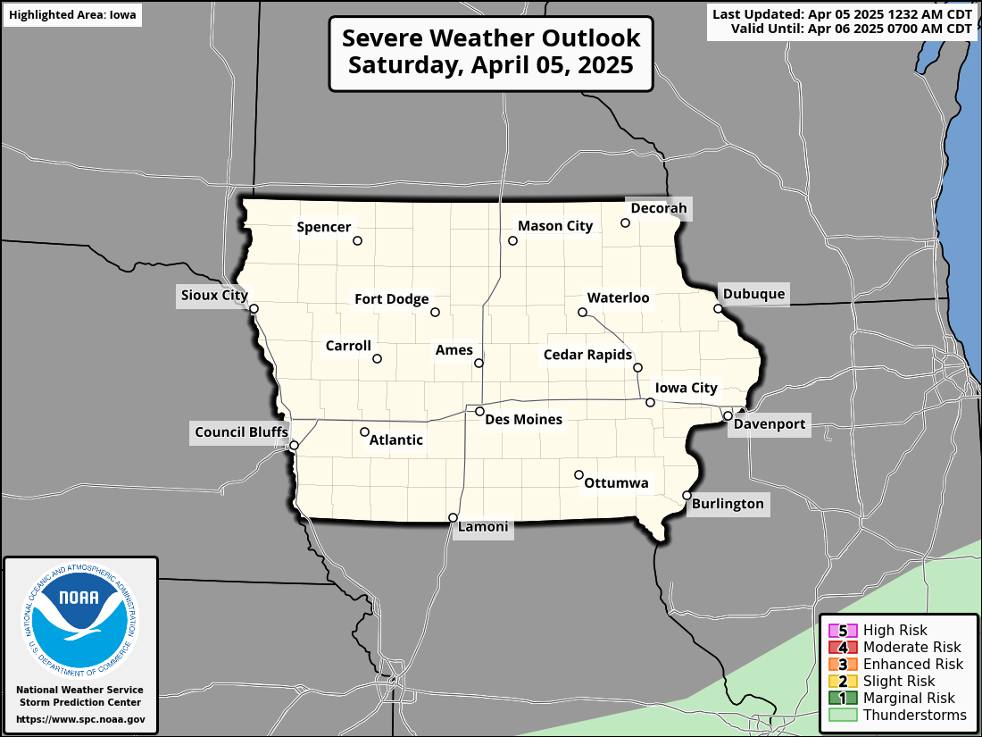
Severe Weather Outlook
Day 1 Severe Weather Outlook
KDMX Radar Loop
Radar imagery from the National Weather Service Des Moines WFO


Significant Severe Weather Threat for Iowa on Monday: Tornado Outbreak Possible
A serious severe weather event is expected to unfold across Iowa on Monday, with a moderate risk for severe thunderstorms focused over central Iowa and extending into southeast Minnesota and western Wisconsin.
A serious severe weather event is expected to unfold across Iowa on Monday, with a moderate risk for severe thunderstorms focused over central Iowa and extending into southeast Minnesota and western Wisconsin. An outbreak of severe storms appears likely, with the primary threats being large hail, damaging wind gusts, and the potential for strong to intense tornadoes, some of which could be long-tracked.
The atmospheric setup is highly concerning. A strong upper-level jet stream will sweep northeastward across the region, while a deepening surface low moves from the northern Plains toward the Great Lakes. In response, warm and humid air will surge northward across Iowa. With broken to scattered cloud cover allowing sunshine to heat the surface, the atmosphere will destabilize rapidly. This will create a volatile environment capable of supporting explosive thunderstorm development.
Storms may begin forming as early as midday across western Iowa and western Minnesota. These initial storms are likely to be supercells, capable of producing very large hail and tornadoes. As the afternoon progresses, storms farther south and east across Iowa are expected to remain more isolated — a setup particularly favorable for strong tornadoes. Supercells that develop within the open warm sector will tap into extreme levels of atmospheric instability and very strong wind shear, increasing the risk for long-lived, intense tornadoes.

By late evening, a powerful cold front will sweep through, likely organizing storms into a squall line. Even as the storms transition to a more linear mode, the threat for damaging winds and embedded tornadoes will persist into the overnight hours.
Iowa sits in the heart of this threat area, where conditions will be most supportive of significant severe weather. Surface heating will be strong enough to erode any lingering cap, allowing storms to form freely. Wind shear values are forecast to exceed 60 knots — a critical ingredient for organized, rotating supercells and tornado production. The combination of strong instability and intense wind shear makes this a particularly dangerous setup.
Residents across Iowa should take this situation seriously. It is important to have multiple reliable ways to receive weather warnings, including NOAA weather radio, weather apps with alert notifications enabled, and access to local news. Make sure your tornado safety plan is in place and that you know where your safest shelter is, ideally in a basement or a small, windowless room on the lowest floor of your home. Charge your devices in advance and remain alert throughout the day, especially during the afternoon and evening hours when conditions will become most volatile.
Days like Monday are rare but extremely dangerous. Iowa is no stranger to severe weather, but the combination of factors coming together on Monday points toward an environment highly supportive of strong tornadoes, destructive hail, and widespread damaging winds. Continue to monitor trusted weather sources closely, stay prepared, and stay safe.

Severe Weather Outbreak Expected This Afternoon and Evening
A significant severe weather outbreak is expected to impact Iowa today, bringing the potential for destructive winds, large hail, and tornadoes, some of which could be strong.
A significant severe weather outbreak is expected to impact Iowa today, bringing the potential for destructive winds, large hail, and tornadoes, some of which could be strong. This system is fast-moving and will develop rapidly, meaning residents should stay alert and have multiple ways to receive weather warnings.
A powerful storm system is moving from the Central Plains into the Upper Midwest, creating conditions favorable for severe thunderstorms. As this system strengthens, it will produce intense wind gusts, significant instability, and heavy rainfall, increasing the risk of hazardous weather across the region.
The primary threats associated with this system include tornadoes, damaging winds, large hail, and flash flooding. Tornadoes could be strong and long-tracked, posing a considerable danger. Wind gusts of 80 to 100 mph are possible, capable of downing trees and power lines, causing structural damage, and making travel extremely hazardous. Hail as large as baseballs could impact some areas, leading to damage to vehicles, roofs, and crops. Additionally, heavy rainfall may result in localized flash flooding, particularly in low-lying and urban areas.
Severe storms are expected to develop early this afternoon, between 1:00 and 3:00 PM, across eastern Nebraska, Kansas, and Missouri before quickly moving into western and central Iowa by late afternoon. Storm activity will continue northeast toward eastern Iowa and the Illinois border into the evening hours. The most intense storms are likely between 4:00 and 10:00 PM, though severe weather could persist into the overnight hours.
Residents are urged to take necessary precautions to ensure their safety. It is essential to stay informed by monitoring weather updates frequently and enabling severe weather alerts on mobile devices. Those in the path of the storms should have a shelter plan in place, ensuring access to a basement or an interior room on the lowest floor of a sturdy building if a tornado warning is issued. Traveling during severe storms should be avoided whenever possible, as high winds, hail, and heavy rain can make road conditions dangerous. Additionally, outdoor objects should be secured to prevent them from becoming airborne in strong winds.
Given the potential for widespread and significant impacts, preparedness is critical. Residents are encouraged to take this threat seriously and remain vigilant throughout the day. If a warning is issued, immediate action should be taken to protect life and property.
For real-time updates and alerts, follow the National Weather Service, local emergency management agencies, and trusted weather sources.

Snow, Sleet, and Freezing Rain Followed by Arctic Cold Next Week
Iowa will experience a mix of snow, sleet, and freezing rain over the next 36 hours, followed by a period of bitter cold as temperatures drop significantly next week.
Short-Term Forecast (Today through Saturday)
Confidence: High to MediumAn Arctic high has moved across the Upper Midwest overnight, bringing some of the coldest air of the season to Iowa. However, temperatures will recover into the teens today as westerly flow aloft helps lift the cold air out of the region. Highs may be slightly lower in the south due to the reflective fresh snowpack, but temperatures will rise steadily through the day.
Later tonight, the surface ridge will exit, and the region will experience a significant warm air advection (WAA) as a deepening wave moves across the state. This will lead to the development of snow for much of the state, although the snow will be lighter than what was seen on Wednesday. Due to a warm nose aloft and limited ice introduction, snowfall will be mixed with sleet and/or freezing rain, especially along the Iowa-Missouri border. Snowfall totals will generally range from 1 to 2 inches across most of Iowa, with localized higher amounts possible in the northeast.
Saturday Forecast
Confidence: MediumSaturday’s forecast remains uncertain due to the interaction of several waves over the Central Plains. Lee cyclogenesis will occur Friday night, which will bring the low-level jet (LLJ) into a WSW to ENE orientation by Saturday. The location and timing of this shift will affect the placement of the system's deformation axis and moisture plume, which will determine where the heaviest snow falls. The highest confidence of snowfall impacts is for eastern and southeast Iowa (50% confidence), but amounts will likely be limited due to the relatively low snow-to-liquid ratios (SLRs) associated with the warm air aloft.
Sunday and Beyond
Confidence: HighA weak wave is expected to bring light snow to the region Sunday, aided by weak lift and a prolonged residence time in the dendritic growth zone (DGZ). While this will not be a major snowfall event, it will bring additional light snow. The cold air will be reinforced, and lows will dip back below zero.
Looking ahead to early next week, another wave of colder air will arrive, making for an extremely cold stretch of days. Highs will be in the single digits, with lows in the teens below zero. It is highly likely that cold weather headlines will be needed due to the dangerously cold conditions.

Winter Storm Warning: Significant Snowfall Expected Across Much of Iowa
Iowa is preparing for widespread, significant snowfall starting late tonight, with hazardous travel conditions expected through Wednesday.

Acute CriticalAlert
Heavy Snowfall Expected: Significant snow will impact much of Iowa, with the highest accumulations (5-8 inches) expected in southern and central Iowa.
Winter Storm Warning: A Winter Storm Warning is in effect from midnight tonight until midnight Wednesday night for southern and central Iowa.
Hazardous Travel: Snow-covered and slick roads will create hazardous travel conditions, especially during the Wednesday morning and evening commutes.
Snow Rates: Snow will fall at rates of a quarter to half an inch per hour, with some periods seeing rates of up to three-quarters of an inch per hour.
FORECAST OVERVIEWSnow will begin over far western Iowa around midnight tonight, spreading into central and eastern Iowa after midnight. The heaviest snow will accumulate in southern and central Iowa, where 5 to 8 inches are expected. Snowfall rates will vary but will generally be between a quarter to half an inch per hour, with some localized periods of heavier snow. Visibility will be reduced in the falling snow, but blowing snow is not expected to be a significant issue, as winds will remain relatively light, averaging 10 to 15 mph.
The snow will taper off from west to east late Wednesday afternoon into Wednesday evening, but hazardous travel conditions will persist through the day, particularly during the morning and evening commutes.
WINTER STORM WARNING DETAILSWhat: Heavy snow expected, with total accumulations between 5 and 8 inches in the warning area.
When: Midnight tonight to midnight Wednesday night.
Impacts: Travel will be very difficult, particularly during the Wednesday morning and evening commutes. Roads will be snow-covered and slick, creating hazardous driving conditions.
PRECAUTIONARY ACTIONSTravel Safety: If you must travel, keep an extra flashlight, food, and water in your vehicle in case of emergency.
Stay Informed: For the latest travel conditions and road updates, check the Iowa 511 app, visit www.511ia.org, or dial 511.
Prepare for a challenging commute as snow impacts much of Iowa. Make sure to stay informed and take necessary precautions to ensure your safety during this winter weather event.