

Watches & Warnings (Iowa)
Last Updated: Loading...
Active Products
Loading...
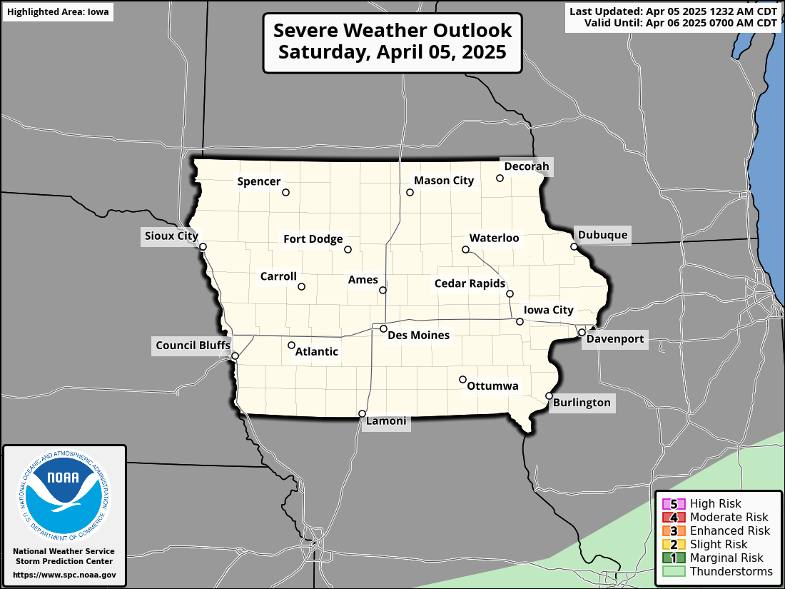
Severe Weather Outlook
Day 1 Severe Weather Outlook
KDMX Radar Loop
Radar imagery from the National Weather Service Des Moines WFO

AcuteAlert: Moderate Risk Expanded, Damaging Winds Expected Tonight
Damaging winds up to 90 mph, large hail, and a few tornadoes are possible this evening into the overnight hours. Storms may arrive after dark—have a way to get warnings and stay weather-aware.
A significant severe weather event is expected to impact parts of northern Iowa this afternoon and tonight. The Storm Prediction Center has issued a Moderate Risk—level 4 out of 5—for severe thunderstorms stretching from eastern South Dakota through southern Minnesota and into northern Iowa.
What’s Expected in Iowa
Storms are expected to begin developing in eastern South Dakota this afternoon and race southeast into Minnesota and northern Iowa by evening and into the overnight hours. These storms will likely organize into one or more intense clusters—what meteorologists call a Mesoscale Convective System (MCS)—capable of producing widespread, destructive straight-line winds.
Key threats include:
Damaging winds between 75–90 mph
A few tornadoes, especially early in the event as storms may start out more isolated
Large hail, primarily early in storm development
Why this setup is concerning:
A hot, humid, and unstable air mass will be in place across Iowa today, with plenty of fuel for storm development (what meteorologists call high CAPE—a measure of storm energy). Combine that with fast upper-level winds and a boundary from earlier storms, and you have a recipe for organized, fast-moving, and potentially damaging storm clusters.
These clusters are expected to form along a temperature boundary (a baroclinic zone) that stretches across northern Iowa. As storms track southeast along this boundary, they could maintain strength well after sunset—meaning parts of Iowa may face severe storms after dark, when they’re harder to see and more dangerous.
Timing for Iowa
Storm arrival: Late afternoon to early evening in northwest Iowa
Widespread impact: Mid-evening through the overnight hours for northern and northeast Iowa
Greatest risk: Along and north of U.S. Highway 20
What You Can Do Now
Prepare for damaging winds: Bring in loose outdoor items, secure trampolines and patio furniture
Review your tornado safety plan, especially if you live in a mobile home or lack a basement
Charge devices and weather radios in case of power outages
Stay weather aware after dark—use a trusted weather app or NOAA weather radio to receive warnings overnight
Bottom Line
This is a potentially high-impact event, especially if storms organize into a fast-moving complex. Northern Iowa is squarely in the path, and the threat includes powerful winds, large hail, and possible tornadoes. Make sure your weather alerts are turned on and check back for updates throughout the day.

Alert: Risk for Severe Weather Increasing
The risk for severe weather is increasing this afternoon, with damaging winds and possibly a tornado expected to develop across parts of the region. A Severe Thunderstorm or Tornado Watch will likely be issued soon.
Severe weather is expected to become more likely this afternoon across portions of southeast Nebraska, northeast Kansas, northwest Missouri, and much of southern to northeast Iowa. A combination of very humid air, a cold front moving in from the west, and a nearby low-pressure system is creating the right conditions for thunderstorms capable of producing damaging wind and possibly even a tornado. The Storm Prediction Center has stated there is an 80% chance that a Severe Thunderstorm or Tornado Watch will be issued soon.
Although cloud cover has reduced sunshine in some areas, it hasn’t stopped the atmosphere from becoming very unstable. There’s plenty of moisture in the air, and storm energy — what meteorologists refer to as “CAPE” — is high, measuring between 2000 and 3000 J/kg. That’s more than enough to support strong thunderstorms, especially along and ahead of the cold front. Storms are already developing in parts of central Iowa, and more are expected to form this afternoon and evening.
In areas like central and northeast Iowa, wind patterns in the atmosphere are more favorable for rotating thunderstorms, also known as supercells. These can produce both damaging straight-line winds and isolated tornadoes. Farther south — across southeast Nebraska, northeast Kansas, southwest Iowa, and northwest Missouri — the wind shear is weaker, but a broken line of storms could still bring pockets of strong, damaging wind gusts as storms push east.
Forecast models suggest that the most likely peak tornado strength today could fall in the EF1 to low-end EF2 range, with wind speeds between 85 and 115 mph. Meanwhile, damaging straight-line wind gusts could reach 55 to 70 mph in the strongest storms.
If you’re in or near the affected area, now is the time to prepare. Make sure you have a way to receive weather warnings — whether that’s a weather app, a NOAA Weather Radio, or local broadcasts. Secure loose outdoor items and be ready to act quickly if a warning is issued. Conditions may change rapidly, and storms could intensify with little advance notice.

Extreme Heat Watch issued ahead of weekend heatwave
Iowa is bracing for a dangerous wave of heat and humidity this weekend. With temperatures soaring and dew points climbing, conditions could become life-threatening for those without access to proper cooling. Here’s what you need to know—and how to stay safe.
An Extreme Heat Watch has been issued for all of Iowa, taking effect Saturday afternoon and continuing through Sunday evening. During this period, heat index values are expected to range from 105°F to 110°F, creating dangerously hot and humid conditions that could persist into early next week. This marks the beginning of a prolonged heat wave that starts Friday and may stretch across several days. The combination of high temperatures and oppressive humidity will make it feel significantly hotter than what the thermometer shows.
These extreme conditions dramatically increase the risk of heat-related illnesses, such as heat exhaustion and heat stroke—particularly for young children, the elderly, individuals with chronic medical conditions, and outdoor workers. The human body becomes less effective at cooling itself in such intense heat, especially when nighttime temperatures stay elevated, offering little relief.
Health officials are urging Iowans to take proactive precautions: stay well-hydrated, remain indoors in air-conditioned spaces whenever possible, avoid direct sunlight during peak hours, and check in on vulnerable family, friends, and neighbors. If you must be outside, wear light-colored clothing, take frequent breaks in the shade, and be alert to signs of overheating such as dizziness, nausea, or confusion.
This weekend’s heat is not just uncomfortable—it’s potentially dangerous. Stay tuned to Acute for real-time weather updates, safety tips, and alert notifications as this heat event unfolds.

Severe Weather Threat for Iowa: Strong Tornadoes, Large Hail, and Damaging Winds Possible
A serious severe weather event is expected to unfold across Iowa on today, with all modes of severe weather—including tornadoes, expected.
A significant severe weather event is expected to impact Iowa later today into tonight. The Storm Prediction Center has placed northern Iowa under a Moderate Risk (Level 4 of 5) for severe thunderstorms, highlighting the potential for strong to intense tornadoes, very large hail, and damaging wind gusts. This threat will primarily target northern Iowa, but some risk extends into central Iowa as well, especially if isolated storms can form farther south.
This setup is driven by a powerful storm system currently moving across the central United States. A strong surface low over South Dakota is pulling warm, moist air northward into Iowa. As the low tracks northeast into Minnesota by this evening, a warm front will lift north across the state, bringing increasing instability (fuel for thunderstorms) and very favorable wind profiles for rotating storms, known as supercells. Dew points are already rising into the 60s, and very strong winds aloft (a jet streak of 70-80 knots at 500mb) are setting the stage for explosive storm development.
Iowa Day 1 Tornado Risk: Yellow and red hatched areas represent a significant tornado threat.
Storms are expected to develop by late afternoon, roughly between 1–3 PM, first near the South Dakota/Minnesota/Iowa border. These storms will quickly move east and southeast across northern Iowa during the late afternoon and evening. The environment south of the warm front — which includes much of northern Iowa — will support the development of discrete supercells, the type of thunderstorms most capable of producing strong tornadoes and very large hail (golf ball size or larger). Wind shear will be strong enough that any storm able to stay isolated could rotate and become tornadic.
There is a chance that storms will eventually cluster into a line later tonight. If this happens, the risk for damaging straight-line winds will increase, but embedded tornadoes would still be possible within that line. Any discrete storms ahead of the main line this evening would have the greatest chance for strong or long-track tornadoes.
Farther south into central Iowa, the severe weather threat is a little more uncertain. While the atmosphere will be very unstable and supportive of severe storms, a cap — a layer of warmer air aloft that suppresses thunderstorm development — might prevent storms from forming unless strong forcing can break through it. If storms do manage to form in central Iowa, they could also become intense very quickly, producing large hail, damaging winds, and possibly tornadoes.
Residents across northern and central Iowa should closely monitor the weather today, have multiple ways to receive warnings, and be prepared to act quickly if a Tornado Warning is issued. Conditions favor rapidly developing and dangerous storms, particularly between late afternoon and midnight. Stay weather-aware, review your safety plans now, and be ready to seek shelter if needed.